Hauptinhalt
DACh-Projekt Mirobriga und Regina Turdulorum: Stadt und Land im fernen Westen des Römischen Reiches
Ansprechpartner in Marburg: Prof. Dr. Felix Teichner, Florian J. Hermann M.A., Kooperationspartner: Prof. Dr. Günther Schörner (Universität Wien)
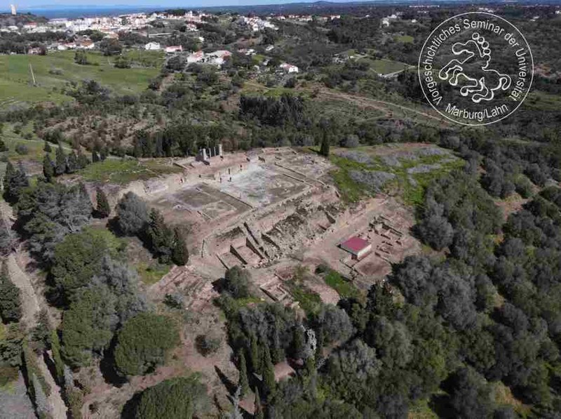
The archaeological landscape project MiReg is a joint project of the Universities of Marburg (Roman Provincial Archaeology, Geoarchaeology) and Vienna (Department of Classical Archaeology) dedicated to study the suburbia and hinterlands of Mirobriga (Santiago do Cacém, Portugal) and Regina Turdulorum (Casas de Reina, Spain). These two smaller urban centres both had strong indigenous roots and mainly indigenous populations during the time period from the late Iron Age until the later Roman era (2nd century BCE to 3rd century CE ). The project aims to highlight similarities, but also differences and modifications in dealing with new social, economic, cultural and political demands resulting from the incorporation into the Roman Empire. By using the same multidisciplinary methodology, two directly comparable multi-facetted data sets regarding systematically selected landscapes and towns are created for the very first time. These data sets can be used to address the relationship between an urban centre and its countryside, to compare the ways of land use and organisation of rural production in connection with the development of the urban centre, and to assess the impact of non-urban residents on the urban settlements as well as the agency of town dwellers in the rural hinterland.
Central research questions
-
What are essential similarities and differences between predecessor (pre-Roman) settlements and Imperial towns (structure, architecture and size)?
-
What was the rural hinterland of Mirobriga and Regina like in pre-Roman and Roman times? What was its agricultural and economic demand or capacity?
-
Are there indications of continuity and persistence or do we see altered (‘Romanised’) landscapes?
-
Can we identify specific local ways of urban-rural interaction in the west of Roman Hispania or traits common to the Roman Empire?
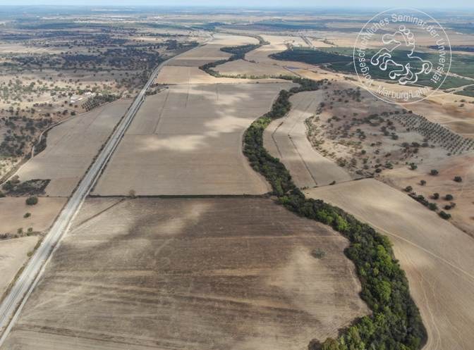
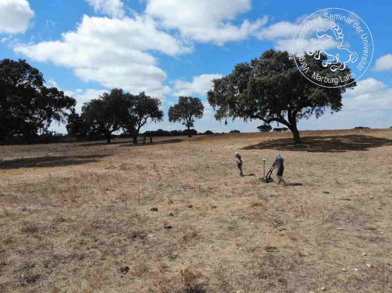
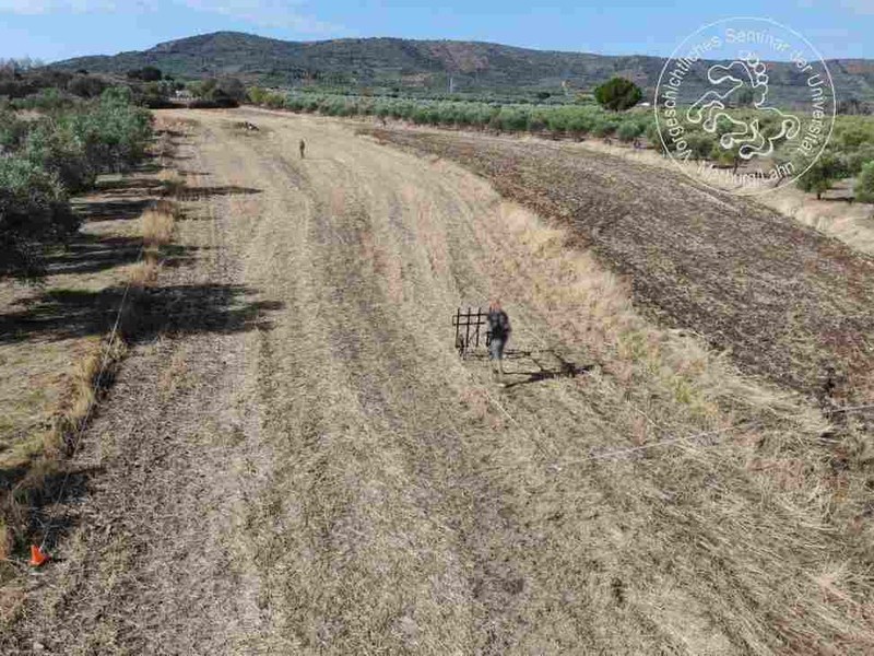
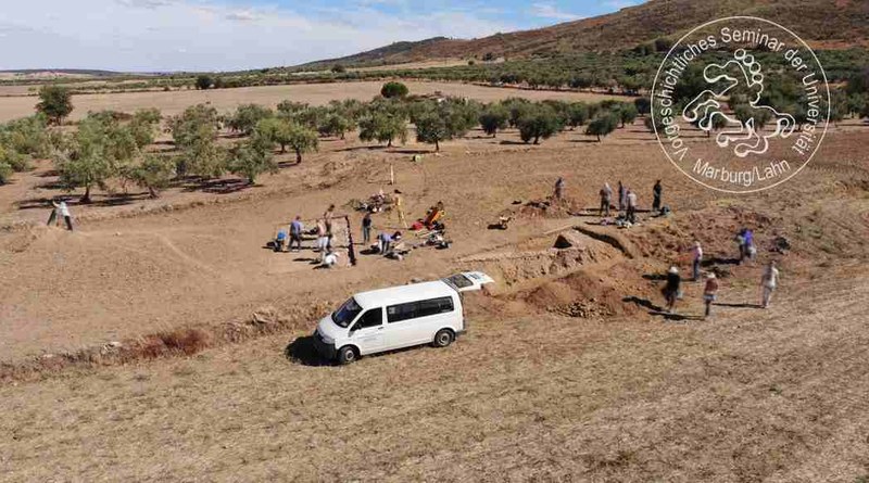
Within the MiReg project we use a multiple-method approach which encompasses small-scale excavations (diagnostic test trenches) with pottery assemblage analysis, archaeobotanical research, geophysical prospection, systematic on-site surveys with an emphasis on individual sites and intensive off-site surveys, as well as remote sensing and geoarchaeological investigations that provide a much broader regional approach.
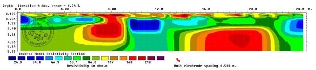
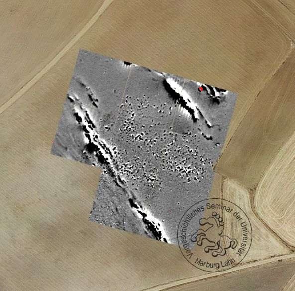
To study the size and layout of rural sites the Marburg-based part of the team uses a combination of different methods, mainly the geophysical “triad” consisting of geomagnetics, ER/ERT (resistivity) and ground-penetrating radar. These allow us to adapt to the complex geomorphological landscapes as well as the ever-changing terrains and soils more or less suitable for one or the other method.
Impressions and examples of geophysical prospection on roman rural and other extra-urban sites.